Import Terrain
|
|
Terrain toolbar (AR) / Extras (ME) |
| Extras menu > Terrain (AR) / Extras menu > Special functions > Terrain (ME) |
The following formats are supported:
ASCII files
Different types of ASCII files are supported:
- ASCII files with unsorted XYZ-coordinate points (*.txt). One point per row.
- ASCII files with sorted XYZ-coordinate points on a rectangular grid.
- ASCII files with XYZ-coordinate points that form triangles.
There are different formatting styles when importing terrain data from ASCII files. A concise selection of relevant rows and columns can be freely configured upon import.
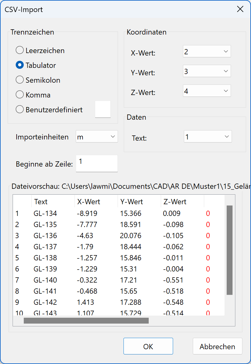
Some settings can be chosen:
- The columns for the X, Y and Z values
- The separator for the values between rows
- The number of rows for the header or from which row the points begin
- The units of the points to be imported
- The column for an info text (optional, limited to 1000 entries)
After the selection has been made, you can start the import with  .
.
INTERLIS format
Import of terrain information from the INTERLIS format. Either *.ili or *.itf files can be selected here. Only the height points are transferred from this format.
Additional 2D data from INTERLIS can be transferred by means of a DXF conversion.
Shape format
Files with *.shp extension can be selected here.
LandXML
New · 16 R3 · Improvements
LandXML.org is an open data standard and is driven by an industry consortium of partners.
LandXML Files can be selected here.
LandXML is a specialized *.xml data file format containing civil engineering and survey measurement data.
General information
External data often contains height information in metres above sea level. This data is also always imported on its absolute height. If the structure settings have no defined height situation for the structure, the terrain is imported high above the building. In this case, simply correct the structure's and project null's height situation to the correct height above sea level.
If the height information is not given in metres above sea level, the imported terrain's height must be adjusted. For this, always use the MOVE POINTS AND CURVES IN Z-DIRECTION function.
The info text is displayed only when activated in the view properties.