Import terrain
In this step, we want to model the premises around our building. The ELITECAD terrain module offers countless functions to allow for simple creation of terrain models. The models can be created from surveyor data or point clouds or simply loaded using an importing interface. For our example project, there is already a complete terrain model, which we must only correctly position.
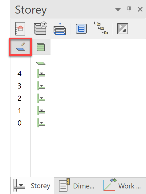
Terrain models are always defined without storey or structure. Go to the storey manager and activate the structure without structures.
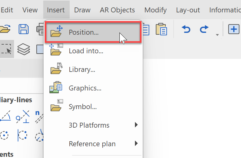
Now, we will insert the prepared terrain model from the project folder by selecting Insert->Position... from the menu bar.
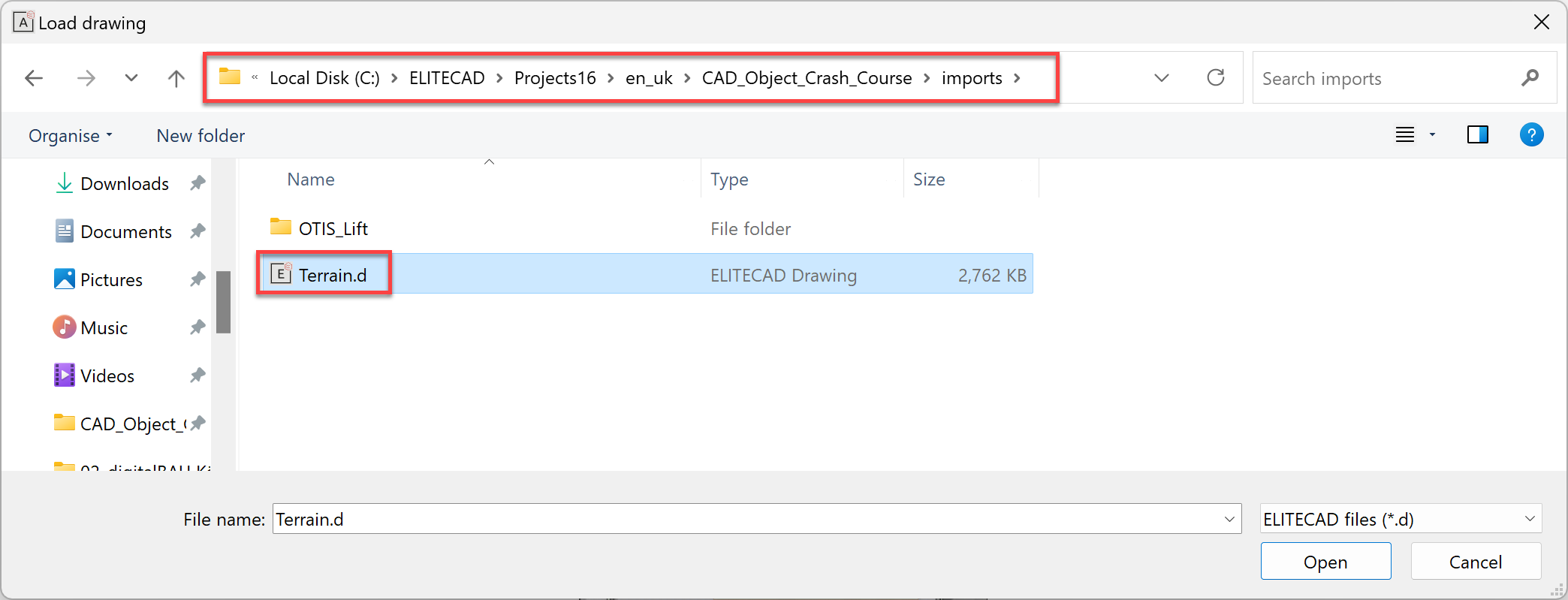
Select the file Terrain.d from the project directory CAD_Object_Crash_Course:
Once you have selected the file, the model is attached to the cursor and must still be correctly placed. Because the terrain has the same project origin as the building model, we must position it on the coordinate point 0/0/0. We accomplish this most simply by using the shortcut Ctrl+1.
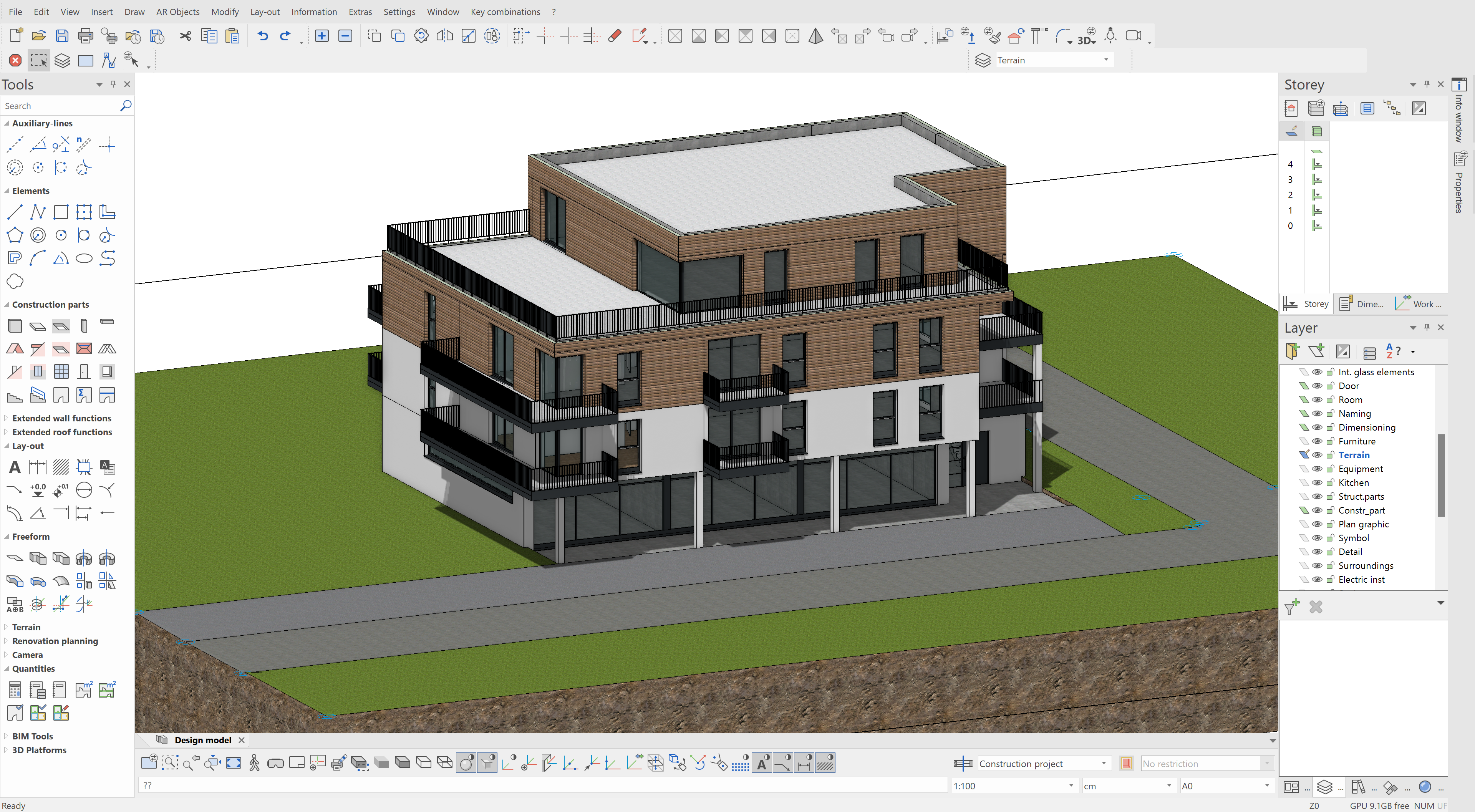
The result should look like this: